


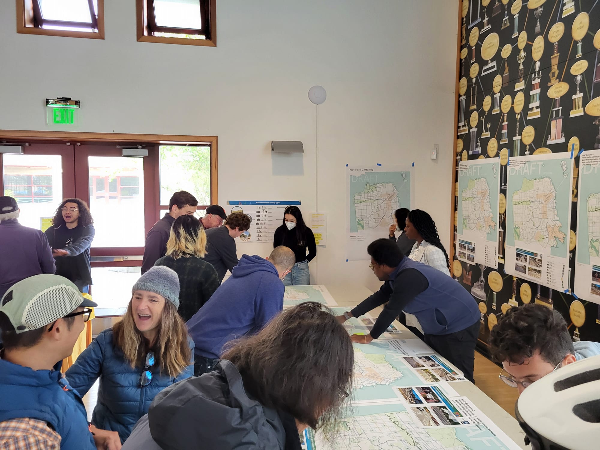
The San Francisco Municipal Transportation Agency hosted an open house for its Biking and Rolling Plan on Sunday at the Minnie and Lovie Recreation Center in Ocean View Park.
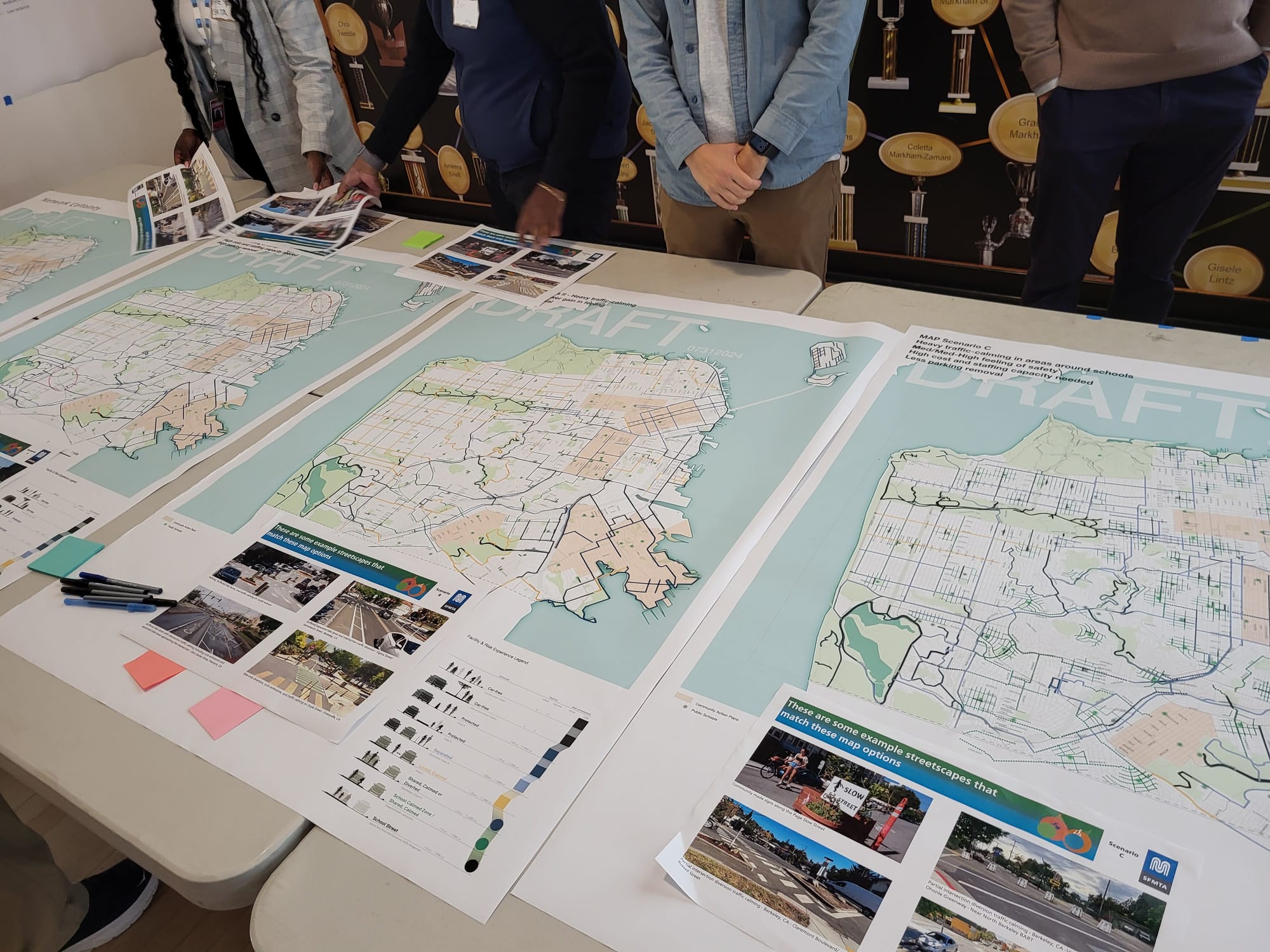
About 10 residents joined the SFMTA staff for a presentation and an interactive activity to collect feedback on the biking and rolling plan, which is meant to reimagine the city’s biking, scooting and rolling infrastructure. Staff showed three city maps that each detailed different focuses like school zones and levels of protected lanes and methods like implementing quick builds or creating car-free streets.
“We've heard a lot from people,” Project Manager Christy Osario said. “Now we're starting to move toward a more singular proposal but before we get to that we wanted to take another opportunity to hear from the public on which way we should be going.”
Started in January 2023, the project updates the current active mobility initiatives to incorporate and support pedestrian and cyclist safety, climate action needs and traveler equity and access. A new bicyclist master plan hadn’t been adopted since 2009, which Osario said was in need of an upgrade due to all the new technologies and methods of traveling like e-bikes and scooters since its implementation.
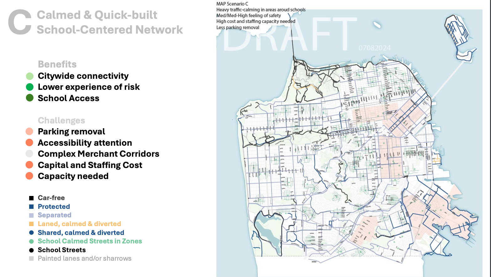
Each map showed different benefits such as citywide connectivity, school access and lower experience of risk. It also showed different levels of challenges that each entails like parking removal, accessibility attention, complex merchant corridors and capital and staffing costs and capacities.
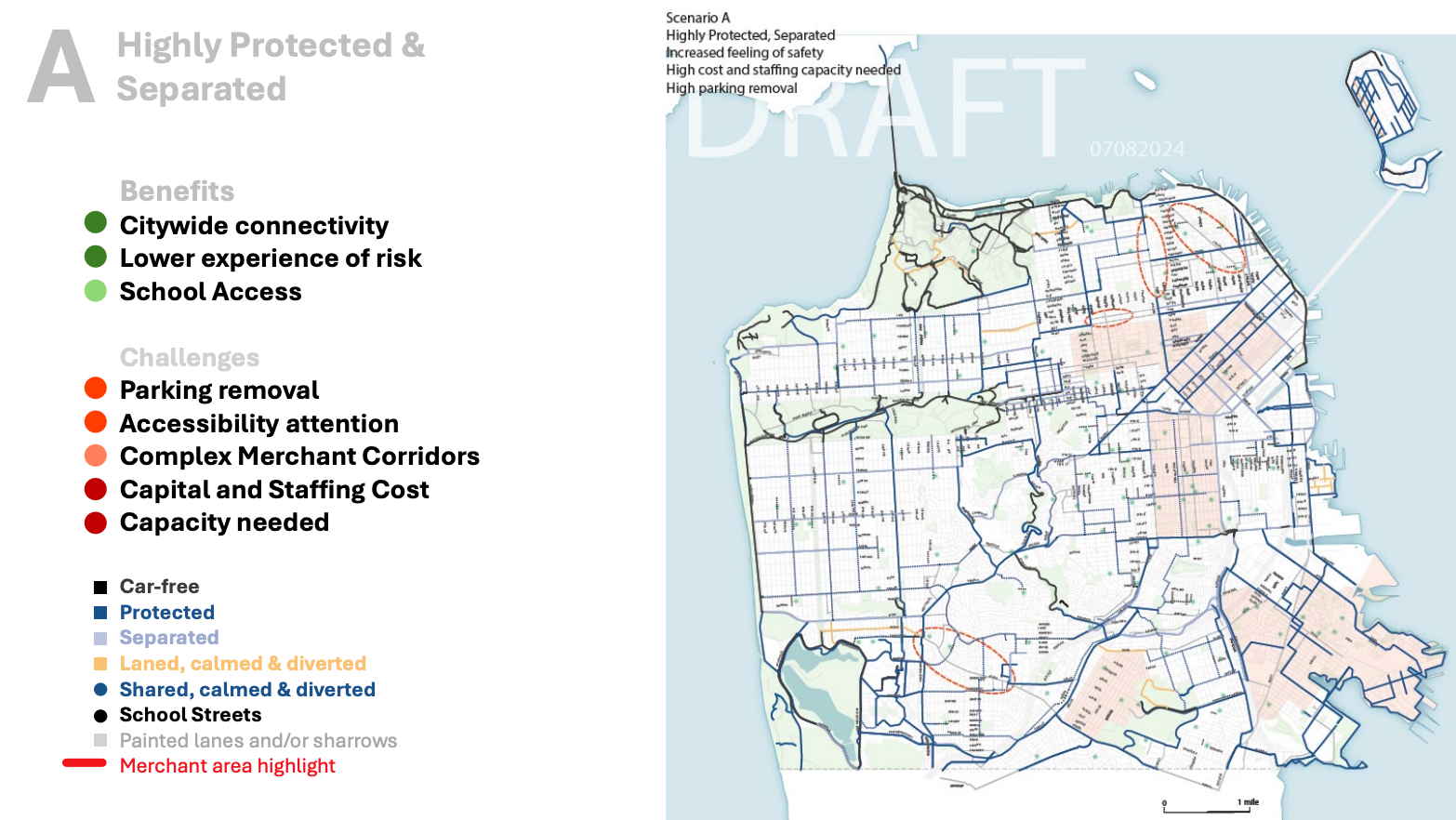
Map A included a highly protected and separated cyclist network by using car-free and slow streets, painted lanes and/or sharrows, calmed and diverted shared, separate lanes with spacers like planter boxes, higher costs and staffing capacities to build and increased parking removal.
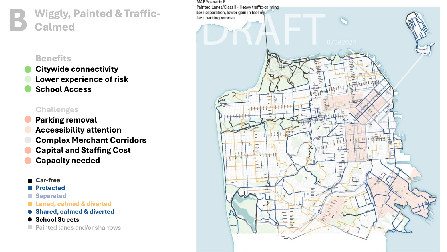
Map B showed a wiggly, painted and traffic-calmed network by using car-free and slow streets, protected and separated lanes and relying more on painted lines, heavy traffic calming measures, paths being laned, calmed and diverted, less intensive parking removal and less separation between car and bike lanes as other plans.
Map C focused on school zones by using heavy traffic calming measures in and around schools, less intensive parking removal and high costs and staffing capacities to build.
Osario also said the maps could be mixed and matched to create an ideal plan. SFMTA has also been working with five community groups, such as Poder SF and the Tenderloin Community Benefit District, to create individual community action plans for those who live in equity-priority communities to help repair past harm.
“I feel like people just want it all, right,” Assistant Engineer Joceline Suhaimi said. “People want parking and people want protected bike lanes and people want traffic calming near schools and it’s like we can’t do it all and if I could wave a magic wand and make everything perfect, obviously I would but I am simply an engineer, which is truly the next best thing, in my opinion, but yeah I think the school one has proven pretty popular so far.”
Attendee feedback centered around five areas of concern. One was safe connection issues like between Ocean Avenue and Holloway Avenue or Frida Kahlo Way, between the Excelsior neighborhood to the San Jose Avenue bike lane, between Geneva Avenue and the BART station and creating east-to-west access throughout Ocean View-Merced Heights-Ingleside neighborhood. Another key issue was implementing physically protected bikeways in areas like Brotherhood Way and Randolph Street.
Other highlighted issues included the need for stricter traffic calming measures along Hearst Avenue and Monterey Boulevard and protected cross-way points along Holloway Avenue at Junipero Serra Boulevard and near rail tracks at Randolph Street and Arch Street.
Excelsior resident John Qin also said there was a need for safe places to lock up bikes.
The three maps presented on Sunday. | Courtesy SFMTA
For residents like Jon Winston, who lives in Sunnyside, parking removal is a necessary tradeoff for creating a network that's safe for pedestrians and cyclists.
“Transit first is transit first,” Winston said. “If a safe bike lane, protected bike lane, means taking out some parking, there shouldn’t be any question about that.”
We Are OMI’s Alyssa Cheung preferred Map A due to the highly protected and separated paths and was pleased to see the priority along Brotherhood Way. She also said there was a need for stronger and safer connections for cyclists and pedestrians from OMI to other areas like Excelsior and Lake Merced that weren’t only along busy streets like Brotherhood Way.
“This plan is not just about biking,” Cheung said. “It’s about prioritizing other forms of transit that are not driving and making it safer.”
The SFMTA is hosting three additional sessions in Districts 5, 6 and 9 this August, with the next set for Aug. 14. creating a refined plan and hosting additional community meetings by Fall 2024.


